How the municipality of Almere is combating flooding with a digital twin
Cooperation between with Nelen & Schuurmans and IMAGEM
IMAGEM and Nelen & Schuurmans have joined forces to help the Municipality of Almere better understand and proactively respond to the impact of flooding. By linking hydrodynamic modeling software and advanced digital twin technology, Almere can not only predict flooding, but also provide visual insight. This provides valuable insights for policymakers, emergency services and residents to limit damage and ensure safety.
Increasing flooding due to climate change
Climate change is having an increasing impact on our daily lives. Heavy rainfall and downpours lead to increased flooding, which can result in serious damage to property, disruption to infrastructure and even risks to public health. Municipalities like Almere face the challenge of preparing better for this and warning and protecting citizens in a timely manner.
Digital twin and hydrodynamic models
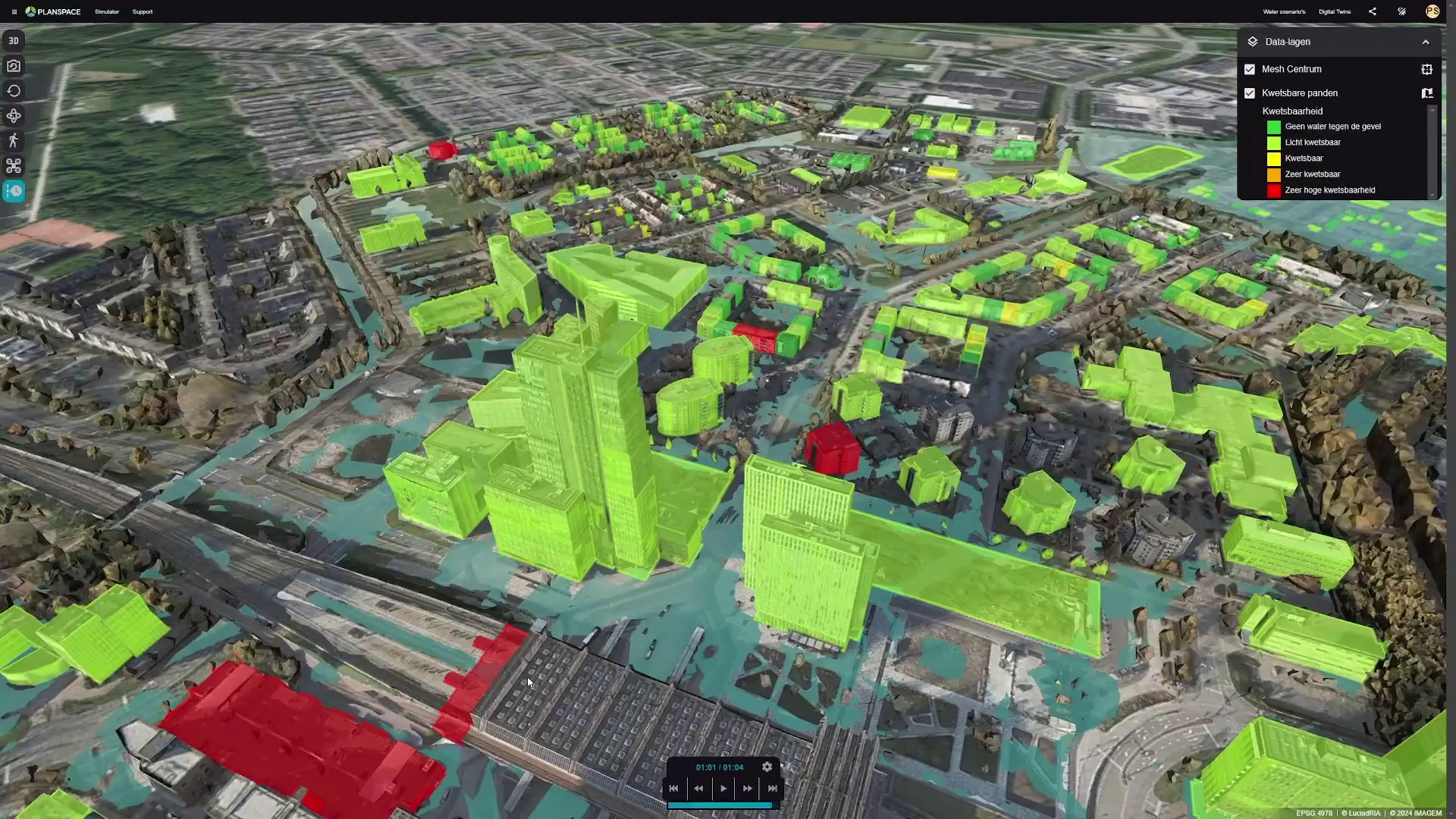
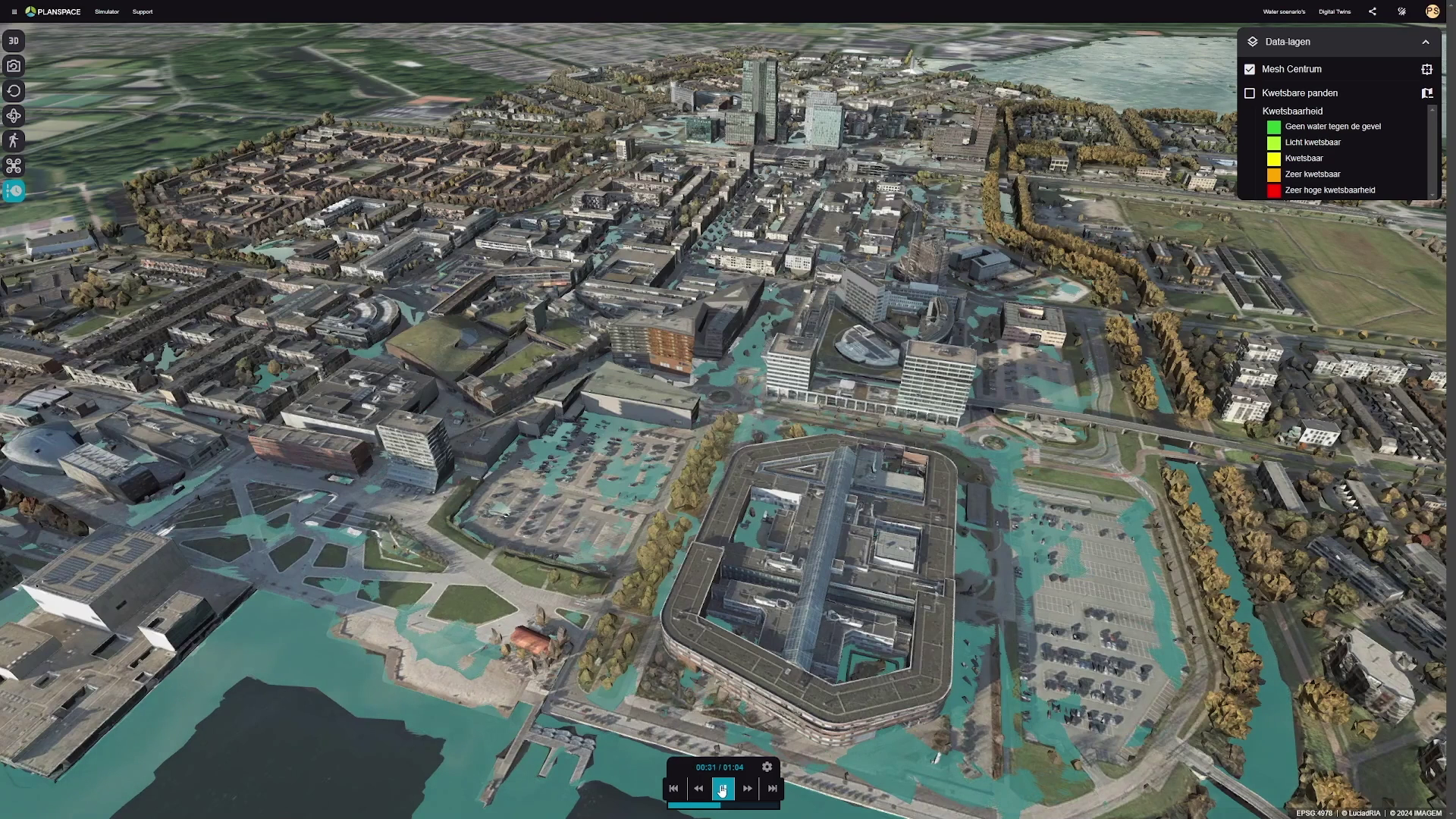
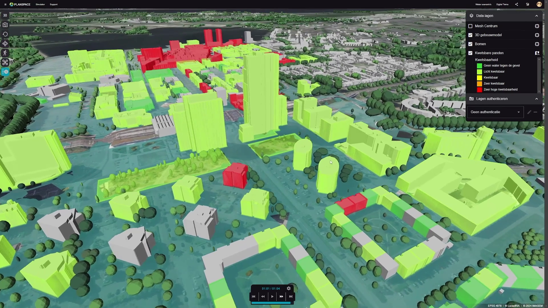
A digital twin provides a powerful tool for visualizing complex environmental data. By enriching Almere’s digital twin with Nelen & Schuurmans’ dynamic hydrodynamic models, policymakers and water experts can better see where flooding will occur and how the water spreads through the city.
For example, they can literally see where water remains after a downpour, which access roads are blocked, where the water crosses the threshold, and even how high the water hits facades. IMAGEM reduced complexity by combining automated 3D city models with interactive simulations, giving everyone – from policymakers to residents – a clear picture of the potential impact of flooding.
Take proactive measures and save costs
A digital twin provides a powerful tool for visualizing complex environmental data. By enriching Almere’s digital twin with Nelen & Schuurmans’ dynamic hydrodynamic models, policymakers and water experts can better see where flooding will occur and how the water spreads through the city.
For example, they can literally see where water remains after a downpour, which access roads are blocked, where the water crosses the threshold, and even how high the water hits facades. IMAGEM reduced complexity by combining automated 3D city models with interactive simulations, giving everyone – from policymakers to residents – a clear picture of the potential impact of flooding.
Want to get started with a digital twin?
Stefan Lijst
Business Consultant
stefan.lijst@imagem.nl
+31 (06) 81 35 50 07
Niels van de Graaf
Market manager - government
niels.vandegraaf@imagem.nl
+31 (0)6 41 64 88 70
about nelen & schuurmans
Nelen & Schuurmans helps create a safe and future-proof living environment worldwide. With smart IT solutions such as the data analysis platform Lizard and the hydrodynamic model 3Di, they provide decision makers with the right information. They also offer advice in the areas of urban water management, climate adaptation, operational water management, flood risks and water in agriculture. Together they work on solutions to flooding and ensure a resilient future!